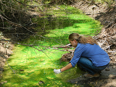
Groundwater tracing is a commonly used technique to understand water movement through karst aquifers like the Edwards. The dissolution of limestone occurs slowly over a long period of time and these opening are pathways or conduits for water to enter the aquifer and for groundwater to move through the aquifer. Tracing can use naturally occurring chemical in the water, introduced chemicals or dyes to track water movement. A tracer is typically introduced into the aquifer through a naturally occurring recharge feature and wells, springs and other water ways are monitored to detect the tracer.
A coordinated tracing program began in the Barton Springs Edwards Aquifer in 1996. Since that time, over 30 traces have been conducted. A special project began in 1996 in conjunction with the Barton Springs/Edwards Aquifer Conservation District (BS/EACD) called the Barton Springs Zone Dye Trace Study. Dye was injected into caves and sinkholes to map water movement in this segment. The goals were to trace the water going into the aquifer at various points in the recharge zone, measure flow rates, and determine which wells and springs the water would emerge from. Travel rates from recharge points to springs varied from 4 miles/day to 0.25 miles/day. Onion Creek is the largest contributor of the watersheds to Barton Springs under normal conditions, but a 2017 study shows that the Blanco River can be a significant source of recharge during drought conditions.
