Overview
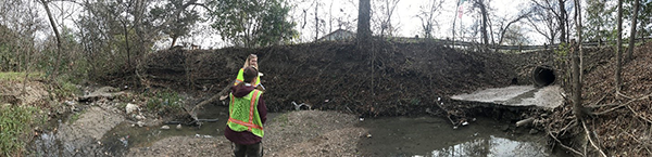
The study will look at a variety of options to improve water quality and erosion along the Clarkson Tributary of Boggy Creek. We will also collect public input as part of the project. The Clarkson Tributary is a high priority due to:
- exposed wastewater pipes,
- poor water quality,
- accumulations of trash and waste, and
- steep banks near roadways and residential structures.
Location
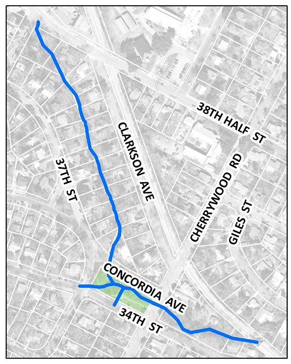
The Clarkson Tributary is about 1,800 feet of creek between Clarkson Avenue and E. 37th Street that flows into Boggy Creek.
Status and Timeline
Our capital improvement projects take many years from start to finish. The process typically includes the following phases:
- Feasibility Study – when information is collected to identify potential solutions.
- Preliminary Engineering – when a solution is identified and costs are estimated.
- Design – when the details are worked out and construction plans drawn up.
- Bidding and Permitting – when a contractor is hired and all permits are acquired.
- Construction – when the project is built.
The project is currently in the feasibility study phase.
Community Engagement
To practice safe physical distancing, we are collecting input for this project online in the summer of 2020. Community input will be included in possible solutions, where feasible.
Additional Information
A water quality monitoring site is downstream of the Clarkson Tributary. The tributary shows poor contact recreation scores because of high e.coli levels. For more information see the Environmental Integrity Index. The tributary is part of the “BOG3” watershed on this recent map with summaries and report.
Contact Info
Lindsay Olinde, Project Engineer, 512-974-1867, email