click to enlarge
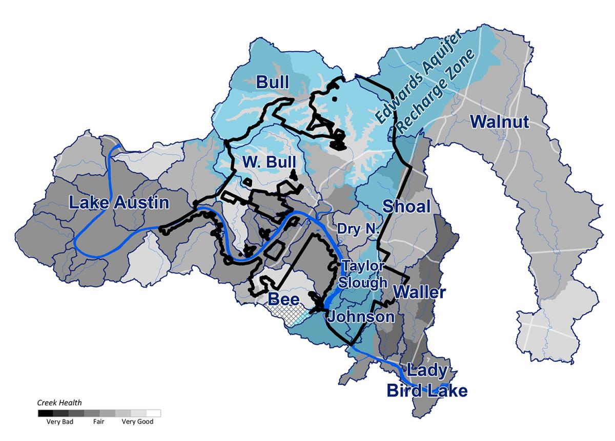
District 10 has the highest level of tree canopy of all the districts and one of the highest levels of protected open space, including over 5,000 acres of the Balcones Canyonlands Preserve system.
Over 80 percent of the district drains to the drinking water supply reservoir of Lake Austin. In addition, 30 percent of the district lies over the recharge zone of the Northern Edwards Aquifer. Springs discharging from the aquifer provide critical habitat for the threatened Jollyville Plateau Salamander.
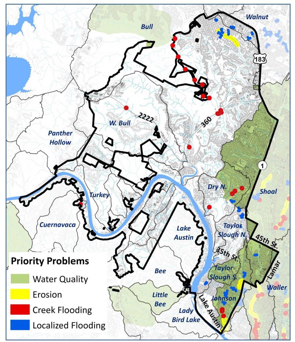
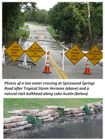
District 10 has numerous low water crossings, which can be hazardous to cross during floods. High priority flooded structures and roadways are shown in red on the map below. Three crossings of Bull Creek and its tributaries by Old Spicewood Springs Road are among the most problematic crossings in the city, with each crossing 3 to 4 feet underwater in a two-year storm.
The lack of adequate storm drain infrastructure in the older urban core and outlying annexed areas contributes to localized flooding of buildings, streets, and yards. Major clusters of drainage complaints are shown in blue on the map below. Older systems in the Bull Creek and Lake Austin watersheds are among the highest priorities for storm drain improvements in the city.
click to enlarge
The Watershed Protection Department addresses drainage and environmental problems using a three-tiered approach of capital improvement projects, programs, and regulations. Examples of these strategies in District 10 include:
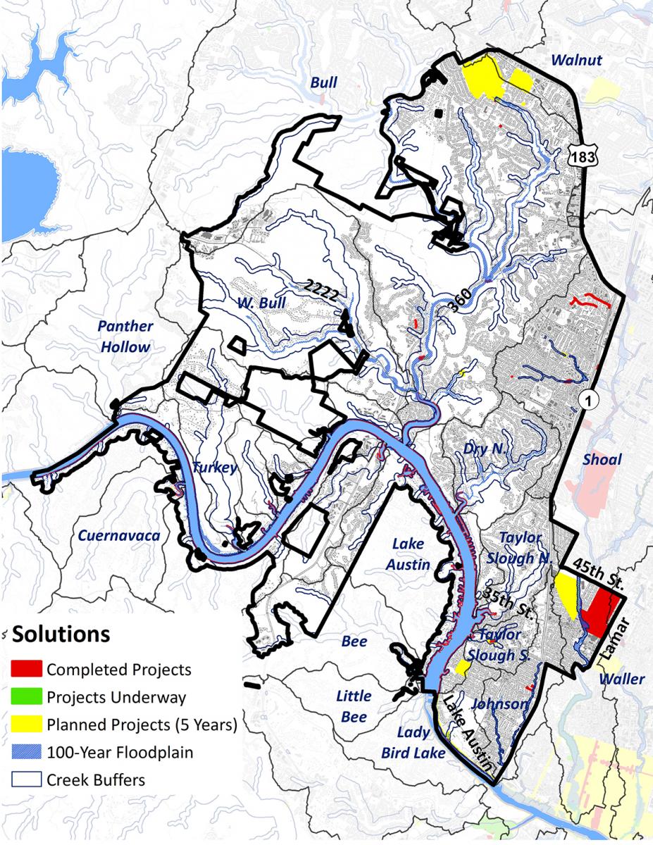
- Capital Improvement Projects: Watershed Protection has constructed several stormwater ponds in this district, as well as storm drain upgrades in the Shoal and Johnson Creek watersheds and improvements to the low water crossing at Lakewood Drive. Projects are also planned for the next five years, including storm drain upgrades in the Walnut, Bull, and Lake Austin watersheds, improvements to stormwater pond dams, management of invasive Hydrilla vegetation, and restoration of native aquatic vegetation along Lake Austin and Lady Bird Lake.
- Programs: Given the numerous low water crossings in this district, the Flood Early Warning System (FEWS) is an important program. Designed to protect citizens from potential harm due to flash flooding, the system consists of gauges throughout the city wirelessly reporting data back to a central station for management and decision-making. Based on this data, FEWS engineers make predictions on where flooding will occur, which the Office of Emergency Management staff uses to direct emergency responders and notify the public. For example, staff can remotely activate flashing warning signs or direct field personnel to place “Turn Around Don’t Drown” barricades, as shown in the photo below.
- Regulations: With the first watershed protection ordinances for the Lake Austin watershed adopted in the late 1970s, regulations have been a key strategy in this district for over 35 years. Since over 90 percent of the district has either been built out or preserved as open space, regulations will mostly apply to redevelopment projects moving forward, which are required to build water quality ponds and protect against additional erosion and flooding. In addition, staff recently revised the code to implement recommendations of the Lake Austin Task Force related to docks, bulkheads, trams, and a zoning overlay.
click to enlarge
Download Watershed Protection District 10 Profile PDF 2.4 MB