City of Austin
FOR IMMEDIATE RELEASERelease Date:
Contact: Watershed Protection Media Line 512-974-1450

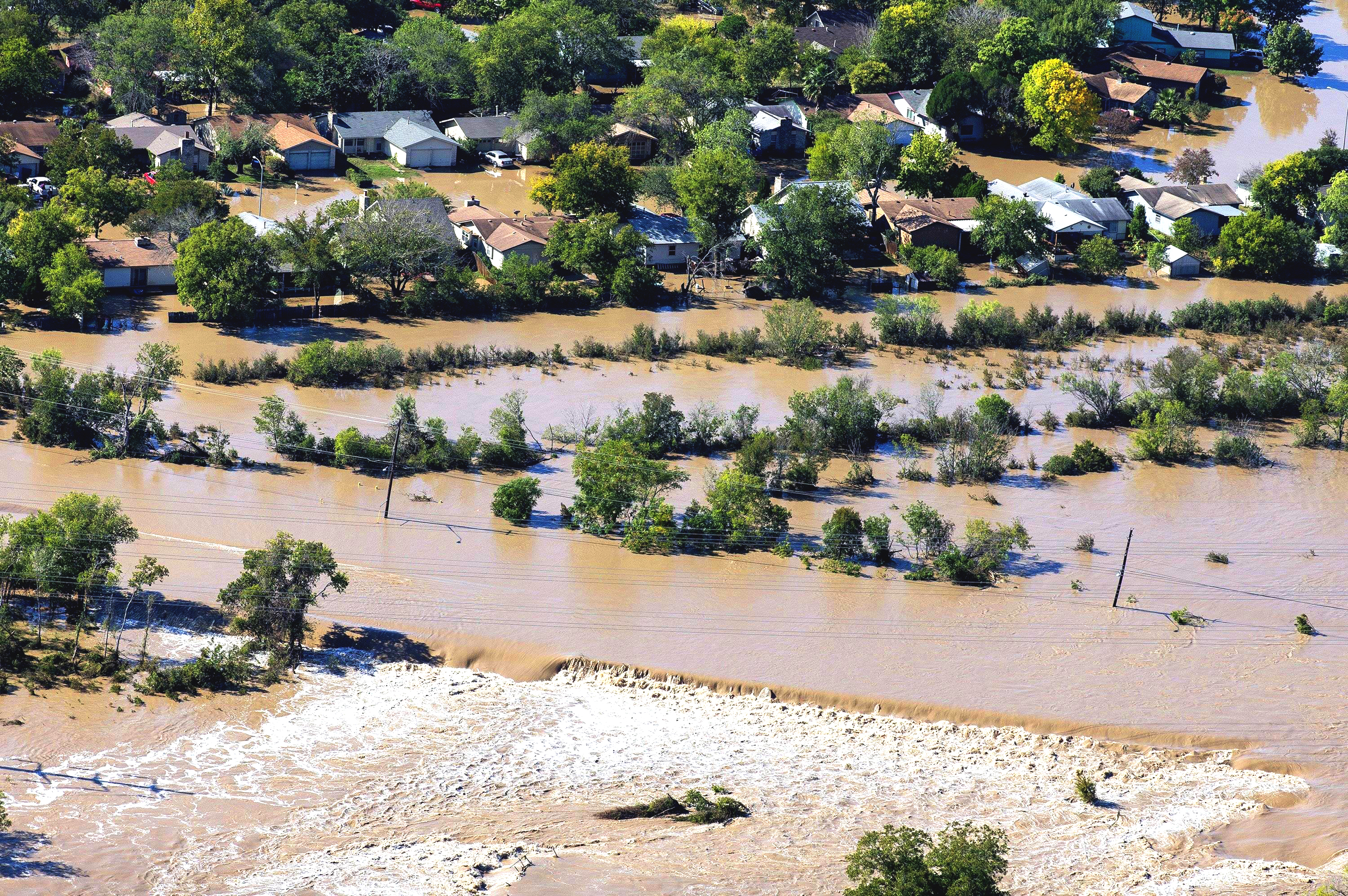
On October 30-31, 2013, heavy rain fell across Austin, causing Onion, Bull, Shoal, Walnut, and Williamson creeks to leave their banks.
On October 30-31, 2013, heavy rain fell across Austin, causing Onion, Bull, Shoal, Walnut, and Williamson creeks to leave their banks. The rainfall totals in the Onion Creek watershed upstream of Austin caused a flash flood that hit portions of South Austin in the early morning hours. Water passed under I-35 and inundated several neighborhoods between I-35 and US Highway 183. Floodwater closed 40 roads and impacted 745 homes in Travis County. Five individuals lost their lives. Today marks the tenth anniversary of this tragic event.
Earlier this month, Council Member Vanessa Fuentes presented a proclamation designating October 31st, 2023, as 2013 Austin Flood Remembrance Day. “Can we do better? Absolutely. Are we working to do better? Yes, we are,” remarked Dove Springs community leader Constable George Morales at the presentation of the proclamation. “I want to compliment the City of Austin because they’re taking the necessary steps.”
Austin Responds
Despite the devastation and loss that occurred in October 2013, the Austin community came together to help neighbors in need. From doing laundry and preparing meals to returning possessions that in some cases had been washed far downstream, Austinites exhibited strength and resiliency.
In response to the devastating 2013 flood, the City of Austin has completed buyouts along Onion Creek, improved technology, hardened flood gauges, and strengthened our partnerships with the National Weather Service, U. S. Geological Survey, local news media, and community organizations. The City has completed more than 40 projects in Onion, Bull, Shoal, Walnut, and Williamson creek watersheds since the 2013 Austin Flood.
“Our mission to protect lives, property and the environment is just as important as ever and we will continue to do more,” said Jorge Morales, Director of the Watershed Protection Department.
Austin Prepares
The City of Austin is committed to building a flood-resilient community through construction projects, regulations, education and engagement. While our projects and efforts have lowered the risk of flooding, we cannot eliminate it completely due to our weather, topography and geography. Austin is located in Flash Flood Alley and is vulnerable to extraordinary amounts of rain in a short amount of time. Our creeks will always be subject to flash flooding. There are more than 400 roads and 7,200 buildings at risk of flooding from a 100-year flood.
We encourage Austinites to be weather ready and visit ATXFloodSafety.com for flood related resources, including:
- Real-time road closures through ATXFloods.com
- Floodplain maps
- Disaster-related mental health resources
- Flood insurance information
- What to include in your emergency plan
- WarnCentralTexas emergency alerts sign up
Austin Remembers
Austin Parks and Recreation brought local officials and the community together for the unveiling of the Onion Creek Mural Project on October 28, 2023, in Onion Creek Metropolitan Park. The memorial mural was created in collaboration with Onion Creek flood survivors who participated in a series of focus groups with artist Alonso Estrada. The mural is inspired by an ancient Native American myth of a wild white horse that inhabited Onion Creek. It tells the story of the strength of the flood waters and the fortitude of the community members that survived. If you were unable to attend the unveiling, you may visit the mural which is located near the intersection of Vine Hill and Onion Creek Drives.
