
Erosion Projects
Creek erosion occurs when flowing water removes soil and rocks from stream banks and streambeds. Creek erosion can threaten homes, roads, bridges, trees, parkland, utilities and other infrastructure. We work on projects that address erosion to create safe and stable stream systems. We use native materials and vegetation as much as possible to enhance the natural creek setting.
This page summarizes the process of our work and highlights several projects.

Featured Project
Richmond Tributary Rehabilitation
This project will repair and stabilize approximately 1,800 linear feet of stream bank along the Richmond Tributary to Williamson Creek. This project will protect yards, trees, buildings and infrastructure by stabilizing the streambank.
- Watershed - Williamson Creek
- Location - The Richmond Tributary is a small creek that flows into Williamson Creek, south of Ben White Boulevard. This project is located behind homes on Richmond Avenue and Gillis Street, between Redd Street and the railroad tracks.
- Status - Construction is expected to start in the fall of 2026.
- Opinion of Probable Construction Cost - $6.3 million
- Easements - Easements were required for this project from property owners along the eroding creek. We will be accessing these easements to stabilize the creek bank and complete the project.
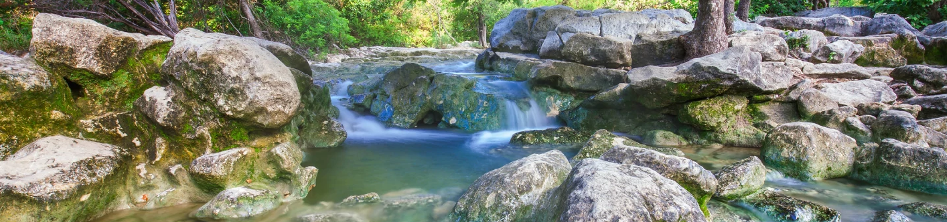
Read more about the Richmond Tributary project below. Note that the photo is of a completed project at Stacy Park.
About Erosion Projects
- Easements
We sometimes need to purchase easements from private property owners to construct our projects. Easements are a legal right that allows us to use a designated portion of another person’s property for a specific purpose. There are many different types of easements, and the specified purpose can vary. Additionally, easements can be temporary or permanent. For our drainage projects, we generally purchase both temporary easements for construction and permanent drainage easements.
- Learn more about drainage easements
- Process and Timeline
Our capital improvement projects take many years from start to finish. The process typically includes the following phases:
- Feasibility Study – when information is collected to identify potential solutions.
- Preliminary Engineering – when a solution is identified and costs are estimated.
- Design and Permitting – when the details are worked out and construction plans drawn up.
- Bidding – when a contractor is hired and all permits are acquired.
- Construction – when the project is built.
Construction is dependent upon the availability of funding. In some cases, we are not able to identify a feasible or cost-effective solution during the first two phases.
Project Summaries
This study will assess possible solutions to improve water quality and erosion along the Clarkson Tributary of Boggy Creek.
- Watershed - Clarkson Tributary to Boggy Creek
- Location - The Clarkson Tributary is a small creek that runs between Clarkson Avenue and E. 37th Street. It flows into Boggy Creek and is about 1,800 feet long.
- Status - This project is currently in the preliminary engineering phase. Construction depends on the results of the study and the availability of funding.
Overview
We would like to address the following issues:
- Exposed wastewater pipes
- Poor water quality
- Steep banks near roadways and residential structures.
There is a water quality monitoring site is downstream of the Clarkson Tributary. Currently, the tributary is not suitable for contact recreation due to high E. coli levels. Explore this water quality tool to find most recent information for its subwatershed (listed as BOG3).
Key Contact for Clarkson Project
- Lindsay Olinde, Project Engineer, 512-974-1867
This project will stabilize approximately 1,400 feet of stream bank along the Eubank Tributary. This small creek runs behind Eubank Drive and feeds into Walnut Creek.
- Watershed - Walnut Creek
- Location - The project is along the creek located between Eubank Drive and Lamar Boulevard, from North Bend Drive to Walnut Creek. View location map.
- Status - This project is currently in the design phase, which is expected to wrap up in 2026. Construction is dependent upon the availability of funding.
- Opinion of Probable Construction Cost - $5.3 million
Project Overview
The goal is to protect yards, trees, buildings and infrastructure by stabilizing the stream banks. The project includes the following:
- Stabilization of the creek to prevent loss of land and fences from erosion
- Enhance native vegetation along the stream banks
- Restore the natural function of the stream
- New landscaping and planting throughout the project area
Key Contact for Eubank Project
- Ingrid Tower, Project Lead, 737-351-0138
This project will protect yards, trees, buildings and infrastructure by stabilizing the streambank. It will also reduce localized flooding on Jamestown Drive.
- Watershed - Little Walnut Creek
- Location - The Jamestown Tributary is a small creek that flows into Little Walnut Creek. The project is along Jamestown Drive, just west of Lamar Boulevard and south of Payton Gin Road.
- Status - Construction began on April 13, 2026.
- Opinion of Probable Construction Cost - $8.2 million
- Easements - Easements were required for this project on properties along the Jamestown Tributary where the banks were eroding.
Get the Latest Information
- Read the most recent Jamestown project update from April 10, 2026.
- Sign up for Jamestown email updates
Overview of the Jamestown Project
- Stabilizes approximately 2,500 feet of streambank, from Thurmond Drive to Payton Gin Pocket Park, using natural limestone boulders, mechanically stabilized earth walls, and graded slopes.
- Upgrades storm drain pipes along Jamestown Drive.
- Installs a bridge over the creek on Fairfield Drive to reduce flooding over the roadway. The bridge will replace the culvert.
- Plants native vegetation along the streambanks and remove large concrete debris. This will restore the natural character of the creek and improve water quality.
What to Expect During Construction
Construction can be stressful to people, trees and wildlife. We will do everything we can to help. Please reach out to the construction inspector with any concerns.
Work will be between 7 a.m. and 7 p.m. on weekdays and potentially some weekends. Please expect the following:
- Noise, dust, and vibrations
- Detours, lane closures and no parking areas
- Limited tree trimming, if branches are hanging low over the street
- Digging behind the curb in some spots to install inlets.
- Workers and equipment in the creek behind houses.
- Closed areas in the Jamestown Neighborhood Park
Water and Utilities
We will need to shut off water at least once to complete some of the work for this project. We will leave a notice 48 hours in advance with two exceptions:
- We may briefly turn off water without notice to test valves and equipment ahead of a planned outage.
- There is always the possibility of a temporary, loss of water or other service if a pipe or line is broken. We’ll respond immediately to restore service if this happens. We have done a lot of research ahead of time to pinpoint where all the underground utilities are. This should help us avoid breaking any pipes.
Get more information about water outages.
Staging Areas
We will be storing equipment and materials at a staging area on approved easements as well as within the work areas. Fencing will be installed around the staging area.
Home Access
You will always have access to your home, but please allow an extra 15 minutes to enter and exit your driveway when work is directly in front of your house. Please set your garbage, recycling and yard trimmings out as normal.
During the paving operations you may not be able to access your driveway while we pave directly in front of it. This is typically a 30-minute delay. Days when work is directly in front of your house, we will notify you of potential delays to your driveway and kindly ask that you please park cars on a nearby street when your driveway is not accessible.
Trees
Trees are important to us, but we will need to remove some to complete this project. We will be taking steps to protect other trees with fencing or planking. We may trim low-hanging branches.
Fish
We need a dry work area to complete this project and will be installing a temporary dam to dry out part of the creek. We will be moving fish out of the way to a safe location first!
Here’s What You Need to Do
For the most part, please go about your normal activities as usual. Leave a little extra time when traveling, slow down around our workers and don’t park in temporary “No Parking” areas.
Your safety is important to us! Please stay out of fenced-off areas and keep children and pets away from construction and equipment. If you’re on foot or on your bike, please follow the detours as well.
Key Contact for Jamestown Project
- Darryl Haba, Project Manager, 512-293-8052
This project will repair and stabilize approximately 1,800 linear feet of stream bank along the Richmond Tributary to Williamson Creek. This project will protect yards, trees, buildings and infrastructure by stabilizing the streambank.
- Watershed - Williamson Creek
- Location - The Richmond Tributary is a small creek that flows into Williamson Creek, south of Ben White Boulevard. This project is located behind homes on Richmond Avenue and Gillis Street, between Redd Street and the railroad tracks.
- Status - Construction is expected to start in the fall of 2026.
- Opinion of Probable Construction Cost - $6.3 million
- Easements - Easements were required for this project from property owners along the eroding creek. We will be accessing these easements to stabilize the creek bank and complete the project.
Overview of Richmond Tributary Project
The project includes the following:
- Stabilization of the creek to prevent property from erosion
- Creek beautification through the use of natural and native materials
- New landscaping and planting throughout the project area
- Relocation of water and wastewater lines
- Culvert upgrades at Philco and Green Forest Drive to reduce flood risks
What to Expect During Construction
- Construction noise during work hours
- Construction traffic on neighborhood streets
- Utility pole relocation
- Removal of trees near creek
- Fence relocation and replacement
Key Contacts for Richmond Project
- Ria Yamaguchi, Project Manager, 512-974-9125
- Helen Hartman, Project Sponsor, 512-974-1844
This project will stabilize approximately 800 feet of a small creek to help protect homes, utilities and natural areas. It will reduce erosion and improve water quality in the creek.
- Watershed - Thompkins Tributary to Walnut Creek
- Location - Thompkins Tributary is a small creek that flows into Walnut Creek. The project area is near Lavinia Lane and Peggotty Place, close to Thompkins Drive in northeast Austin. The area is just east of North Lamar Boulevard and north of Rundberg Lane.
- Status - This project is anticipated to begin construction in March of 2026.
- Opinion of Probable Construction Cost - $1.16 million
- Easements - Select temporary workspace easements were acquired for this project from property owners along the eroding creek. We will be accessing these easements to stabilize the creek bank and complete the project.
Get the Latest Information
- Sign up for Thompkins Tributary email updates.
Overview of Thompkins Tributary Project
- Channel improvements from Trotwood Drive to Peggotty Place.
- We’ll use rock, gravel and wood to reconstruct channel and enhance wildlife habitat.
- Small pools in the channel to filter pollutants out of storm water and slow down floodwaters.
- Native plants along the creek banks.
- Storm drain upgrades in the channel to change the outfall and improve water quality.
What to Expect During Construction
Work hours are 7 a.m. to 7 p.m. Monday through Friday. The contractor has the option to work 9 a.m. to 6 p.m. Saturdays. Please expect:
- Construction noise during work hours,
- Construction traffic on neighborhood streets
- Removal of trees near creek
- Fence relocation and replacement
Documents
- Thompkins Tributary Presentation from Feb. 12, 2026
Key Contacts for Thompkins Project
- Kelley Rich, P.E., CFM, Engineer C, Austin Watershed Protection, 737-393-6100
- Hank Marley, Project Manager, Austin Capital Delivery Services, 512-974-2966
- Armando Montes III, P.E., Austin Watershed Protection, Project Sponsor, 512-974-1759
This project will stabilize and restore approximately 1,500 feet of Williamson Creek Tributary 4, known as Turtle Creek, in South Austin. Erosion has damaged both residential and commercial properties.
- Watershed - Williamson Creek
- Location - The project is divided into two locations:
- Along backyards of Middleham Place, between Eberhart Lane and Turtle Creek Blvd.
- Between properties near Stassney and Hummingbird Lanes
- Status - This project is currently in design with construction estimated to begin in late 2026.
- Opinion of Probable Construction Cost - $2.7 million
Overview of the Turtle Creek Project
Plans include:
- Grading and sloping the creek banks
- Limestone block walls and grade controls
- Native vegetation along the banks
- Rock riffles to enhance the creeks environment and support biodiversity.
In addition to stabilizing the creek banks, the project will improve wildlife habitat, protect private property and public infrastructure from future damage.
Key Contact for Turtle Creek Project
- Donald Heisch, Project Sponsor, 512-550-1556
Don’t see your project?
It may be considered a creek flood, local flood or water quality-related project. A complete list of Capital Improvement Program projects is available on Capital Project Explorer.