Overview
Watershed Protection has received several flooding complaints of buildings and yards in this area. The type of flooding occurring in this neighborhood is known as local flooding. It generally occurs away from creeks when the drainage system is overwhelmed by heavy rainfall. In this neighborhood, most stormwater is conveyed by storm drains, ditches and channels, and streets to a channel west of Burnet Road.
This project is starting preliminary engineering in the December 2022. In this phase, crews will be working in the area occasionally over the next year to perform field studies, survey, and locate existing utilities. The results of the preliminary engineering study will be shared publicly once it is available.
Flood Survey
Residents have reported 11 locations of building flooding and 15 locations of yard flooding. Please tell us about your experiences with flooding through our online form. This will help us design the most effective solution. There is an option to send flood photos at the end of the form. Please have any photos that you would like to share ready to upload before filling out the form.
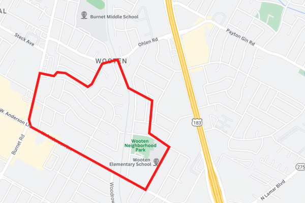
Project Map
This map shows the project's preliminary boundary. It is subject to change based on findings during the preliminary engineering phase.

Status and Timeline
Our capital improvement projects take many years from start to finish. The process typically includes the following phases:
- Preliminary Engineering – when a solution is identified and costs are estimated.
- Design – when the details are worked out and construction plans drawn up.
- Permitting and Bidding – when a contractor is hired and all permits are acquired.
- Construction – when the project is built.
This project is currently in the preliminary engineering phase.
Email Updates
Email Stephanie Lott to receive email updates about future public meetings and project updates or call 512-974-2799.
Contacts

