
Parkland Dedication Fee Collection and Expenditures
Parkland Dedication Cases and Project Information - View an interactive map displaying each individual “case” in which parkland dedication fees were paid for the last five years. A “case” is described as a subdivision or site plan submitted to the City of Austin for approval through the Development Services Department. Cases are identified as points on a map with the case name, case number, address of the case and fee paid. In addition, information is posted showing the land acquisition or park project the case was assigned to fund.
Points are identified as available, planned, complete.
- Available cases are funds that have not been assigned to either land acquisition or a park improvement project.
- Planned cases are funds that have been assigned to either land acquisition or a park improvement project.
- Complete cases are funds that were assigned and the project is complete.
For more detailed information regarding available Parkland Dedication funds and/or expenditures please send an e-mail with your request.
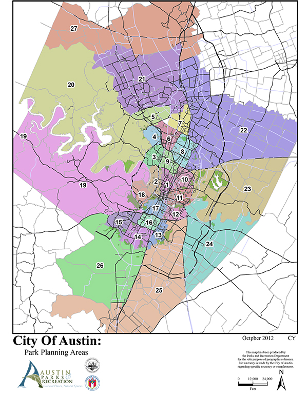
The expenditures are prioritized within each planning area. These priorities are based on following order:
- Possibilities for land acquisition in a “Parkland Deficient Area”. The deficient area map can be viewed on the Property Profile GIS Viewer Please use by clicking on Change visible map layers in the Search & Identify Data tab near the top, clicking on the plus sign next to Long Range Planning on the left panel, checking the box next Parkland Deficient Area, and zooming in until the layer appears.
- New park amenities within a two-mile radius of where the funds were generated
- Priorities within the planning area based on PARD’s Long Range Plan
- New park amenities to the nearest district or metropolitan park