The Brentwood neighborhood’s drainage problems rank as a high priority for the Watershed Protection department.
Components of this project include studies that will:
- Determine a large-scale solution that will reduce the frequency and severity of flooding
- Include water quality improvements to help filter stormwater
- Address comprehensive stream restoration or critical erosion hotspot solutions
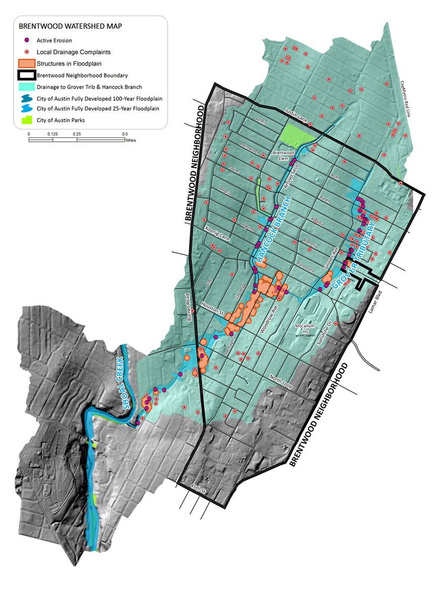
Location
The Brentwood neighborhood study area includes Upper Hancock branch area, including the Goodnight Tributary, to the confluence with the Grover Creek Tributary, and the Grover Creek Tributary upstream of the confluence.

History
Developed throughout the 1940s and 1950s, the Brentwood neighborhood was built with small storm drains that result in frequent street and structure flooding. Further development of the neighborhood was completed largely without stormwater control measures. Creek channels have widened as a result, and erosion threatens streets, storm drain outfalls, utilities, culverts, houses, fences, and yards.
Multiple studies have been done to evaluate the flooding in this area. Below is a summary of some of the major studies and their individual outcomes.
- 2008 - 2010 Study – looked at eliminating structure and yard flooding in the 100-year event in the Grover basin. Was determined to be non-feasible due to the limited area of study and a high estimated cost for implementation.
- 2012 - 2013 Study – looked at providing flooding relief by maximizing green stormwater infrastructure in the Grover basin. This study also had a limited study area, would only address the 10-year event, and proposed measures to be implemented primarily on private property, which was determined to be non-feasible from a maintenance and long-term reliability standpoint.
- 2015 – Watershed Protection department staff prepared a memo to summarize known issues in the neighborhood, and recommended smaller-scale, intermediate solutions. This memo kickstarted the Brentwood Capital Improvement Program project current efforts.
- 2016 – Brentwood CIP project kicked off with Feasibility Phase 1, which focused on gathering materials, reviewing information from previous studies, and developing a plan to move forward with a feasible project that would provide a long-term solution to the area’s flooding and drainage issues.
Project Status
The City’s engineering consultant analyzed a multitude of drainage improvements to reduce flood risk throughout the Brentwood Neighborhood. The City selected an alternative presented by the consultant which maximizes a feasible flood risk reduction. The engineering consultant is currently developing a Preliminary Engineering Report to refine potential improvements and define project costs, implementation schedule, and constraints.
Current Project Timeline
Feasibility Study
- 2016 - 2017 – Phase 1 – collected and reviewed data from past studies
- 2018 - 2021 – Phase 2 – feasible alternatives identified and selected
Preliminary Engineering Study
- 2023 – Notice to Proceed issued to engineering consultant
- Fall 2024 – PER phase anticipated to conclude
Design/Bid/Construction
Questions
Please reach out to one of the following people: